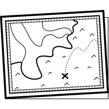






This detailed map illustration serves as a crucial tool for coastal navigation, showcasing various geographical features and landmarks along the sea. Designed with clarity in mind, it highlights important locations such as ports, marinas, and navigational aids, making it ideal for sailors, marine researchers, and coastal planners. The map includes a variety of symbols and annotations that provide essential information about water depths, currents, and potential hazards, ensuring safe and efficient travel across maritime routes. Its versatile design allows for integration into digital applications, educational materials, or printed guides, catering to both professional and recreational users interested in marine exploration and coastal management.



Part of the
Sea SVG collection,
in Nature.
Download the Interactive Map for Coastal Navigation vector as a ready-to-edit .svg file —
it scales to any size without losing quality and can be recoloured in any
vector editor or straight in CSS.